
Καλάθι
COLLINS EUROPE ROAD ATLAS PB SPIRAL BOUND
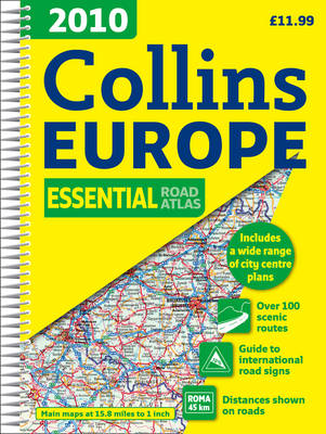
A4 format Scale 1:1 000 000 (1 cm to 10 kms / 1 inch to 16 miles) A fully revised edition of A4 spiral road atlas containing road mapping, route planning maps, larger scale road maps of the Ruhr and Rhine, city through route maps, city centre plans and a comprehensive place names index. MAIN FEATURES Clear, easy to follow road maps at a scale of 1:1 000 000. Euroroutes and motorways are easily distinguished on the mapping. The maps also show international road classifications, road distances in kilometres and relief is shown by attractive layer tints. INCLUDES • Route planning maps • A range of route maps of major cities: • A selection of centre street plans of major cities. Also includes larger scale road mapping extending from Amsterdam to Munich and making route following easier through this densely populated area. WHO THE PRODUCT IS OF INTEREST TO Motorists planning a journey in Europe and for use en route.
| Default | |
| Language | ΑΓΓΛΙΚΑ |
| Pages | 288 |
| Publisher | HARPER COLLINS |
-
0%
-
0%
-
0%
-
0%
-
0%
Αξιολογήσεις COLLINS EUROPE ROAD ATLAS PB SPIRAL BOUND
Συνολικές Αξιολογήσεις (0)
κάντε κλικ εδώ για να γράψετε αξιολόγηση για αυτό το προϊόν.
Αναφέρετε αυτή την αξιολόγηση.
Τιμή Καταστήματος: 16,70€
Τιμή Web
19,06€
- Κωδικός: tsi.014946
- Βάρος: 0.78kgr
- Διαστάσεις: 29.70cm x 21.00cm x 1.60cm
- SKU: 9780007317929
- ISBN: 9780007317929