
BestPrice.gr
Πάπυρος Βιβλιοπωλεία
Ο Λογαριασμός μου
Συνδεθείτε για να απολαύσετε τα προνόμια του λογαριασμού BOOKMARKT
Λίστα Αγαπημένων (0)
Καλάθι

ΠΑΡΝΗΘΑ ΠΕΖΟΠΟΡΙΚΟΣ ΧΑΡΤΗΣ TOPO 25 5Η ΕΚΔΟΣΗ
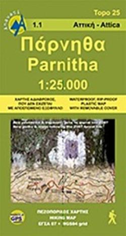
ΠΑΡΝΗΘΑ ΠΕΖΟΠΟΡΙΚΟΣ ΧΑΡΤΗΣ TOPO 25 5Η ΕΚΔΟΣΗ
  • Διαθέσιμο σε 2-3 ημέρες αναλόγως με την διαθεσιμότητα του εκδότη
  • ΑΝΑΒΑΣΗ
New and updated 2024 hiking map for Parnitha mountain in a scale 1:25 000. On the back of the map there are two zoomed maps in scale 1:10 000, for the area of Flampouri and Fyli. Parnitha is the ideal destination for a short walk or a small hike near Athens. Everyone who lives in Athens has at least once taken the cable car to the Casino and from there walked to Mpafi refuge. Or gone down the route Chouni. One of the best routes is the Flampouri ridge because it is so wild you forgot you are so close to home.  Parnitha, the highest mountain in Attica, is a natural reserve where the Athenians come in contact with nature. The fir forest, the ravines and endless, scrubland, deers and birds are the manifestations of the wildlife we come looking for. It is an ideal destination for hiking, climbing, mountain bike, or even to build a snowman. This Anavasi map has been reprinted many times and it presents the unnumerable paths of mount Parnitha with remarkable detail and accuracy, with all the information useful to hikers. This map is no longer just our own project, as it has been enriched by the comments and routes suggested by many friends and hikers, making the map even better.
Default
Language ΑΓΓΛΙΚΑ
Pages 1
Publisher ΑΝΑΒΑΣΗ
Writer ΜΑΤΣΟΥΚΑ ΠΗΝΕΛΟΠΗ
  • 0%
  • 0%
  • 0%
  • 0%
  • 0%

Αξιολογήσεις ΠΑΡΝΗΘΑ ΠΕΖΟΠΟΡΙΚΟΣ ΧΑΡΤΗΣ TOPO 25 5Η ΕΚΔΟΣΗ

Συνολικές Αξιολογήσεις (0)
κάντε κλικ εδώ για να γράψετε αξιολόγηση για αυτό το προϊόν.


Τιμή Καταστήματος: 16,70€
Τιμή Web
9,50€
  • Κωδικός: tsi.085293
  • Βάρος: 0.11kgr
  • SKU: 960-8195-55-1
  • ISBN: 9789608195554